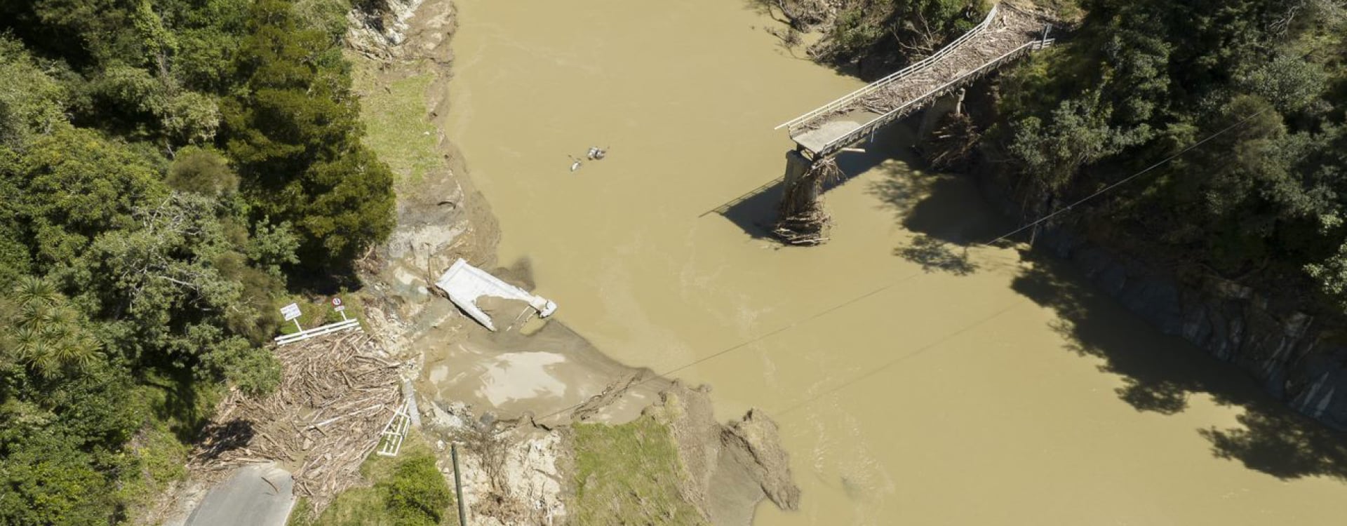
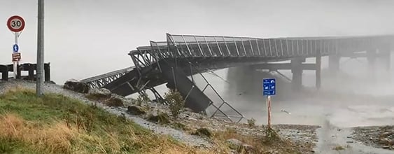
If Cyclone Gabrielle has taught us anything, it’s that Aotearoa New Zealand’s infrastructure challenges are inextricably linked with climate change. Extensive damage was caused to homes, infrastructure, and livelihoods across northern and eastern regions. It was our costliest non-earthquake natural disaster, also leading to loss of life, displacement, and emergency declarations in affected areas.
Roading in the crosshairs
The challenges of managing and funding New Zealand’s roads are borne by a mix of local, regional, and national entities. NZ Transport Agency Waka Kotahi (NZTA) manages the country’s state highway network and co-funds all local roads. One of its major priorities is adapting the land transport system to the impacts of climate change, as set out in Tiro Rangi – NZTA's climate adaption plan.
They’ve got every reason to be concerned about climate change. Water is a road’s biggest enemy, and vice versa. Our roads often follow river valleys or across rugged, mountainous terrain – often designed on the back of a cigarette packet, then formed by pick and axe, then later bulldozers, 100 or more years ago by our pioneering forebearers. Often originating as single lane ‘goat track’, these roads have since been widened and improved on, but usually not to our current standards. Many roads are surrounded by erosion- and/or flood-prone land, which, in high intensity rain events, can slip or turn into torrents
Rain is increasingly falling in more intense, localised events. We know from bitter experience that this can wreak havoc on roads and associated infrastructure – causing widespread destruction and disruption.
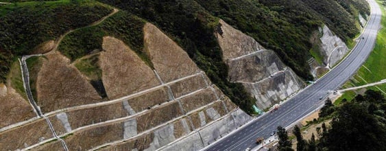
Many weather-related road closures are due to blocked drainage or culverts causing water to scour through or over the surface. Rockfalls and landslides can bury or undercut roads. These are often more destructive, difficult, and costly to fix such as recently completed SH25A repairs in the Coromandel. In both cases, not properly accounting for surface and subsurface water conditions is one of the root causes - and, left unmanaged, can lead to accelerated deterioration and premature failure.
Influence of upstream landscapes
In an uncertain climate future, providing certainty our roads will fulfil levels of service starts with better understanding the complex landscapes that surround them. Why? Because much of the damage done to roads by large storms is influenced by the water movements up-catchment.
In many places during Cyclone Gabrielle, up-catchment areas bore the heaviest brunt of the rainfall. Freshly cleared (e.g., deforested, eroded, or tilled) lands produce more runoff and can generate breathtaking amounts of sediment and forestry slash with often dire consequences for infrastructure.
Effective water management and land use planning strategies are essential to address these upstream-downstream linkages and mitigate the impacts of storms and flooding on communities, ecosystems, and infrastructure. Effective management starts with a solid understanding of the processes, connections, and rates at which water and other materials move through catchments and sites.
Over one hundred years of intensive land development has generally accelerated water flow through New Zealand’s catchments. One way to promote resiliency is to find and implement ways to slow water flow to increase infrastructure and community resilience by diminishing the proverbial wall-of-water.
Combining multidisciplinary thinking
Slowing stormflows is about understanding catchment and site-specific processes, pathways, and rates, then integrating with knowledge of land-use practices and their effects.
Understanding pathways, processes, and rates requires identification and synthesis of the unique combination and interactions of geology, hydrology, ecology through space and time. The field of fluvial geomorphology tells us about the behaviour of waters, materials they carry, and materials and features through which they move. Knowing this from site to catchment (or broader) scales is essential for well-informed decisions about catchment response to land uses.
Land-use practices should be identified and coordinated across disciplines that have traditionally operated independently of one another, such as agriculture, forestry, engineering, asset management, and planning. 'Best practice' development should involve critical examination of current New Zealand practices and careful consideration of overseas practices evaluated through the lens of current science.
Development should be framed to be adaptive and applicable to catchment-specific understanding. The primary sector, for example, has worked for decades to reduce the impact of agriculture on water quality. The main mechanism for doing this? Slowing water flows to allow settling and/or uptake of contaminants.
Having people across infrastructure engineering and land-use disciplines around the same table as individuals who understand how water behaves across landscapes is vital to ensure plans and decisions related our roads, farms, and forestry increase overall system-level resiliency. Such an approach is the best prospect to limit damage when tested by natural hazards.
By putting these heads together, we can look more holistically and better develop plans to manage water flow, including erosion reduction. Road infrastructure ultimately benefits, and our critical transport links become more sustainable.
Hierarchy of controls
Standard risk management practice includes application of 'controls' for managing hazards posed to human values. Controls are organised into a hierarchy based on the degree hazard exposure can be eliminated (top priority) to mitigated (lowest priority).
Using a river analogy, the safest control is not to make contact with the river whereas a lifejacket would be the lowest level of control. In the context of catchment management, the "Tier 1” or top priority is to not short-cut river pathways in the first place. This may include restoring pathways by removing previously engineered features or works. Tier 1 examples include restoring floodplain connectivity, flow path lengths (e.g. channel re-meandering), residence time (e.g. wetlands), and maintaining ground in multi-canopy forest cover with highly integrated and overlapping root networks.
For catchments, the second priority or “Tier 2” could include enhancing existing infrastructure or improving land use practices, for example sustainable forestry or silvopastoral systems. The third priority “Tier 3” could include new engineered controls such as the network application of sediment bunds. These are containment areas where surface water and sediment are stored (temporarily and longer-term, respectively) before entering the channel network. Distributed storage at dozens, hundreds or thousands of locations throughout a catchment can reduce the size of the flood peak and enhances potential to lower inundation, velocities, and related damage downstream.
Hopefully it goes without saying that Tier 4 (e.g., handing out lifejackets or in the case of roads, filling in potholes) is the mitigation of last resort.
One of NZTA’s objectives is to reduce embedded carbon in the infrastructure solutions, which aligns with WSP’s commitment to reduce the carbon associated with our designs and advice by 50% by 2030. What better way to achieve this than to challenge the status quo hard engineering solutions with alternatives that might have better environmental outcomes? There may well be cost benefits as well.
A hybrid critical corridor / catchment approach
Road corridors and the landscapes that surround them must be considered in their entirety as integrated networks to successfully identify appropriate interventions. Such approaches support asset owners in prioritising critical lifelines and more holistically managing risk. Targeted and well-informed efforts like these will make limited funding more effective.
New Zealand faces a critical juncture in Cyclone Gabrielle’s wake. The convergence of science, land-use planning, and engineering holds the promise of resilience. By understanding catchment processes, reconnecting upstream-downstream (and lateral) linkages, and we can slow the frenetic flow of water. Reforestation, wetlands, and other nature-based analogues with permeable surfaces become our allies, transforming roads from mere conduits to guardians of our shared future.