Local governments have access to a range of 3D data products that are either created independently, or commercially.
LIDAR: is often procured and captured by a local government as part of an internal geospatial imagery program. These raw files may be stored internally and can be processed into 3D data products.
DEM: Data can be processed by an imagery provider or independently depending on capability requirements. It can also be processed by LINZ through the National Elevation Program.
LINZ provides a base specification for DEM, DSM and Point Cloud procurement for these datasets to be added to the National DEM, DSM and Point Cloud data services. These datasets go into an open data service available to the public to download for free.
3D Building Models: Some local government agencies may have internal capability to help build this dataset from commercial or authoritative NZ products or thiscan be provided by imagery providers.
Depending on how the data is provided and curated, end data products may produce a different level of detail (LOD) influencing analysis.
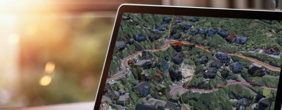
While New Zealand doesn’t yet have a national 3D building model dataset that offers a high level of detail, including 3D building models in your Digital Twin can have transformative analytical and visual power.
Commercial Products: Google Maps, Apple Maps, NearMap, and others offer high-resolution imagery and AI-generated building models.
These products have different commercial offerings that may or may not be viable to use in a local government context. All have varying products, services, formats and imagery resolutions effecting accuracy and usability in a digital twin or geospatial platform.
Government Products: LINZ offer a building outlines dataset that provides a geometric outline of a building. This is a 2D representation of the roof outline of a building also known as LOD0. This dataset can be used as the pre-cursor to a 3D building dataset where the height is extruded to create a LOD1 3D building object.
These datasets can significantly enhance decision-making in urban development and are important in positioning these objects in the right place on our virtual surface, to be as aligned to the real-world as possible.
By integrating all these kinds of data into Digital Twins, local governments can gain valuable insights and achieve positive community outcomes for planning, infrastructure development, and community engagement. - ultimately helping shape efficient, sustainable, resilient, future-ready cities.
Kerri and Istvan thank Professor Robert Amor from Auckland University's Computer Science Department for his peer review of this feature.